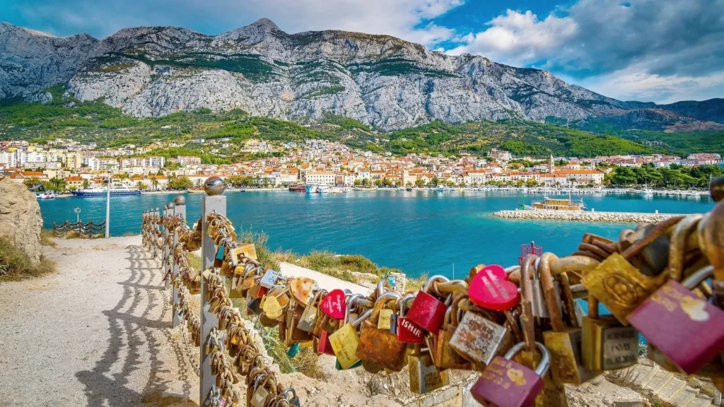
Most travellers who visit Croatia come for the coast — the Dalmatian islands, the walled city of Dubrovnik, the lavender fields of Hvar, the crystal clear Adriatic water that turns every shade of blue and green depending on the depth and the light. The hiking is an afterthought for most visitors — something to do between boat trips and beach days rather than a primary motivation for the journey.
This is a significant miscalculation. Croatia’s hiking landscape is one of the most diverse and most rewarding in Europe — a country whose geography combines high limestone mountain ranges with dramatic coastal cliffs, whose national parks contain some of the most spectacular trail scenery on the continent, and whose network of marked walking routes connects ancient villages, medieval fortresses, Roman ruins, and natural landscapes of extraordinary beauty in ways that reward extended exploration on foot far more than any amount of time spent on a beach or a boat.
The Velebit mountain range — the longest mountain range in Croatia, running parallel to the Dalmatian coast for over 145 kilometres — is one of the great hiking destinations of southeastern Europe, largely unknown outside Croatia despite offering trails and landscapes that rival anything in the more famous Alpine destinations further north. The Paklenica National Park, carved into the southern Velebit, contains some of the most dramatic canyon and ridge hiking in Europe. The Plitvice Lakes National Park — Croatia’s most visited natural attraction — offers a boardwalk trail experience through a waterfall landscape of extraordinary beauty. And the island trails of the Dalmatian archipelago provide coastal and highland walking with views of the Adriatic that are simply impossible to match anywhere else in Europe.
Croatia’s hiking season is long — the combination of Mediterranean climate on the coast and continental climate inland means that trails are accessible from April through November in most regions, with the spring and autumn months offering the finest conditions for serious hiking. The summer heat — intense on exposed coastal and island trails between June and August — requires early starts and careful planning but does not eliminate the hiking season entirely.
This guide covers the finest hiking destinations in Croatia — from the great mountain ranges of the interior to the coastal paths and island trails of the Adriatic — with honest assessments of difficulty, trail conditions, logistics, and what each destination actually delivers for the visitor who chooses to explore Croatia on foot.
Understanding Croatia’s Hiking Landscape
The Geology — Karst Country
Croatia’s hiking landscape is defined by karst geology — the characteristic limestone terrain that produces the dramatic features that make Croatian scenery so distinctive and so visually extraordinary. Karst is limestone that has been dissolved and sculpted by water over millions of years — producing sinkholes, caves, disappearing rivers, dramatic canyons, and the extraordinary system of interconnected lakes and waterfalls that makes Plitvice one of the most beautiful natural landscapes in Europe.
Hiking on karst terrain is a specific experience. The trails are often rocky — loose limestone, sharp edges, and uneven surfaces that require good footwear and careful foot placement. The views are frequently dramatic — karst landscapes tend toward vertical rather than gradual topography, producing sudden drop-offs and extraordinary panoramas that appear unexpectedly as trails round a ridge or emerge from forest cover.
The karst landscape also produces the extraordinary water clarity that makes Croatian rivers and lakes so visually dramatic. The limestone filters water with extraordinary efficiency — producing the turquoise, jade, and deep blue colours of the Plitvice lakes, the Krka waterfalls, and the countless springs and streams that emerge from the limestone mountains throughout the country.
The Mountain Ranges
Croatia has three principal mountain ranges that provide the backbone of its inland hiking landscape.
The Velebit is the longest mountain range in Croatia — running for approximately 145 kilometres along the Dalmatian coast from the Senj area in the north to the Zrmanja River in the south. The Velebit is divided into three sections — the Northern Velebit (Northern Velebit National Park), the Middle Velebit, and the Southern Velebit (Paklenica National Park) — each with its own character and its own hiking attractions. The Velebit is Croatia’s premier hiking mountain — a range of extraordinary beauty, geological complexity, and ecological diversity that is largely unknown outside Croatia despite offering trails of genuinely European significance.
The Dinara is the highest mountain in Croatia — its peak, Sinjal, reaches 1,831 metres — and sits on the border between Croatia and Bosnia and Herzegovina. The Dinara massif is less developed for hiking than the Velebit but offers challenging and rewarding routes to those willing to explore it.
The Gorski Kotar is a highland region in the northwest of Croatia — between the coast and the Croatian interior — characterised by dense forest, high rainfall, and cooler temperatures than the Dalmatian coast. The Gorski Kotar contains Risnjak National Park — a pristine mountain and forest environment that is one of the finest wilderness hiking destinations in Croatia.
The Coastal and Island Trails
Croatia’s coastline and island chains offer a completely different category of hiking experience from the mountain interior — lower elevation, warmer temperatures, extraordinary sea views, and the particular pleasure of walking between ancient stone villages in a Mediterranean landscape of olive groves, vineyards, and dry stone walls.
The Dalmatian coast has several well-developed coastal walking routes — including sections of the E7 European Long Distance Path that traverses Croatia — and the islands of the Dalmatian archipelago have their own internal trail networks that reward exploration on foot. The island trails are among the most visually spectacular in Croatia — combining highland interior walking with sudden and dramatic views of the Adriatic and the surrounding islands.
The Great Hiking Destinations: The Complete Guide
1. Paklenica National Park — Croatia’s Hiking Capital
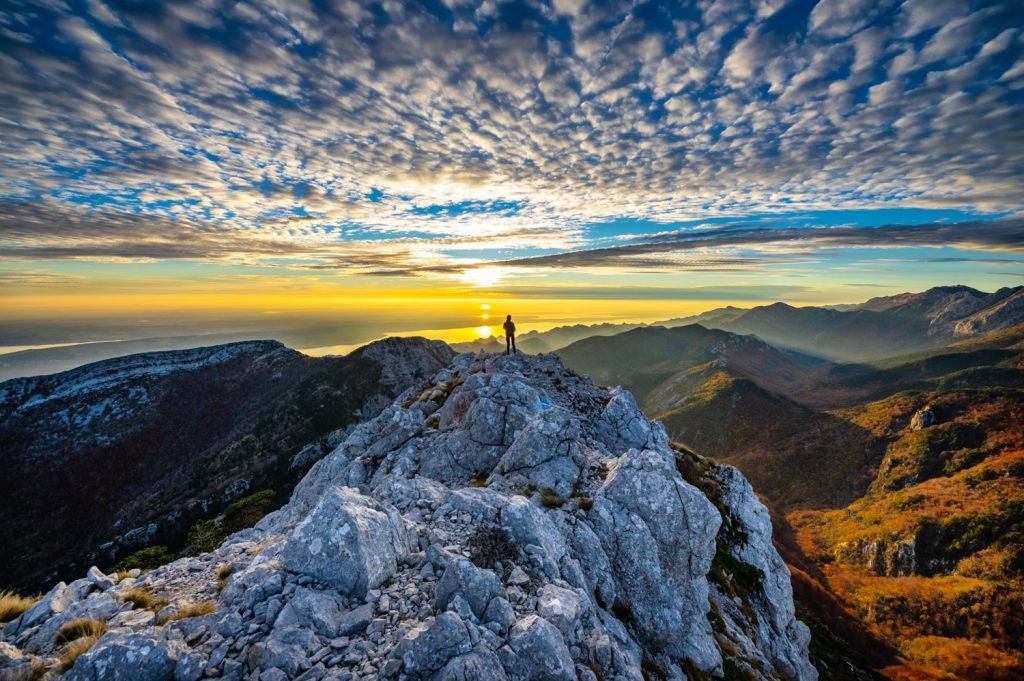
Paklenica National Park is the finest hiking destination in Croatia and one of the great mountain hiking destinations in southeastern Europe — a dramatic karst landscape of deep canyons, towering limestone walls, highland ridges, and dense forest that offers trails ranging from accessible gorge walks to serious multi-day mountain routes.
The park occupies the southern section of the Velebit mountain range — an area of approximately 95 square kilometres centred on two dramatic river canyons, the Velika Paklenica (Big Paklenica) and the Mala Paklenica (Small Paklenica), that cut deep into the limestone massif from the coastal plain near the town of Starigrad-Paklenica. The canyon walls — rising to over 400 metres in places — are among the finest rock climbing venues in Europe and the trails that run through and above them offer scenery of extraordinary drama.
The Main Trails
Velika Paklenica Canyon Trail (Easy to Moderate — 2 to 3 hours return)
The most accessible and most visited trail in the park follows the floor of the Velika Paklenica canyon from the park entrance to the Paklenica mountain hut — a walk of approximately 3.5 kilometres through the deepest and most spectacular section of the canyon. The trail follows the course of the Velika Paklenica stream — sometimes crossing it on stepping stones, sometimes climbing above it on rocky paths — through a gorge whose walls narrow in places to create a dramatic confined passage before opening into the wider upper canyon where the mountain hut sits.
The canyon floor trail is relatively straightforward in terms of navigation and gradient but the rocky terrain and the stream crossings require sturdy footwear — this is not a flip-flop trail despite the number of visitors who attempt it in inappropriate footwear every summer. The trail is extraordinarily beautiful — the combination of the vertical canyon walls, the clear stream, the dense vegetation, and the views of limestone formations above creates a landscape that rewards slow walking and frequent stops.
Vaganački Vrh Summit Trail (Difficult — 6 to 8 hours return)
Vaganački Vrh — at 1,757 metres the highest point in the southern Velebit and one of the highest points in the entire Velebit range — offers one of the finest summit experiences in Croatia. The trail begins at the Paklenica mountain hut in the upper canyon and climbs steeply through the limestone karst terrain to the ridge and then to the summit — a total ascent of approximately 1,200 metres from the canyon floor.
The summit panorama is extraordinary — on clear days the view encompasses the entire Dalmatian coast from the Kvarner Gulf to the northern islands, the Kornati archipelago visible as a scattering of islands in the blue Adriatic, and the mountain landscape of the Velebit stretching north and south. The descent returns by the same route — steep and requiring careful footing on the loose limestone.
This is a serious mountain hike requiring full day preparation — good boots, sufficient water (there is no reliable water source above the mountain hut), food, sun protection, and the fitness to handle a long day of steep terrain. It is entirely achievable for fit walkers without technical climbing skills.
Manita Peć Cave Trail (Easy — 3 to 4 hours return from park entrance)
The Manita Peć cave — one of the largest and most beautiful caves in the Velebit — is accessible via a trail that branches from the main canyon trail and climbs the canyon wall to a cave entrance at approximately 570 metres altitude. The cave itself is open to guided visits and contains extraordinary stalactite and stalagmite formations in a sequence of chambers of considerable size and beauty.
The trail to the cave entrance is steep but well-marked — the views of the canyon from the approach path are among the finest available without committing to a full summit day.
Mala Paklenica Canyon (Moderate — 4 to 5 hours)
The smaller of the two Paklenica canyons — accessed from a separate trailhead approximately 4 kilometres from the Velika Paklenica entrance — is less visited than its larger neighbour and rewards the visitor with a wilder, quieter, and in some ways more dramatic experience. The Mala Paklenica canyon is narrower and more technically demanding than the Velika Paklenica — the trail involves some scrambling sections and requires more careful navigation — but it delivers an experience of genuine adventure and genuine solitude even at the height of the tourist season.
Practical Information
Getting there: The park entrance is located near the town of Starigrad-Paklenica on the Adriatic coastal highway (D8). Starigrad-Paklenica is served by buses from Zadar (approximately 1 hour) and Split (approximately 2.5 hours). During the summer season buses from Split and Zadar stop directly at the park entrance.
Park entrance fee: Approximately 60 kuna (EUR 8) per person — paid at the park entrance. The fee includes access to all trails and the Manita Peć cave visit requires an additional fee and must be booked in advance.
Mountain hut accommodation: The Paklenica mountain hut (Planinarski dom Paklenica) is located in the upper canyon and provides dormitory accommodation, meals, and water for multi-day hikers. Book in advance for summer visits.
Best season: April to June and September to November. July and August are hot and crowded — early starts (before 7 AM) are essential in summer to avoid both the heat and the crowds on the canyon trail.
What to bring: Sturdy hiking boots are essential — the rocky canyon terrain is extremely hard on ankles and feet in anything less. Sufficient water — the canyon stream is not reliably safe to drink. Sun protection — the upper canyon and ridge sections are fully exposed.
2. Northern Velebit National Park — The Wilderness Experience
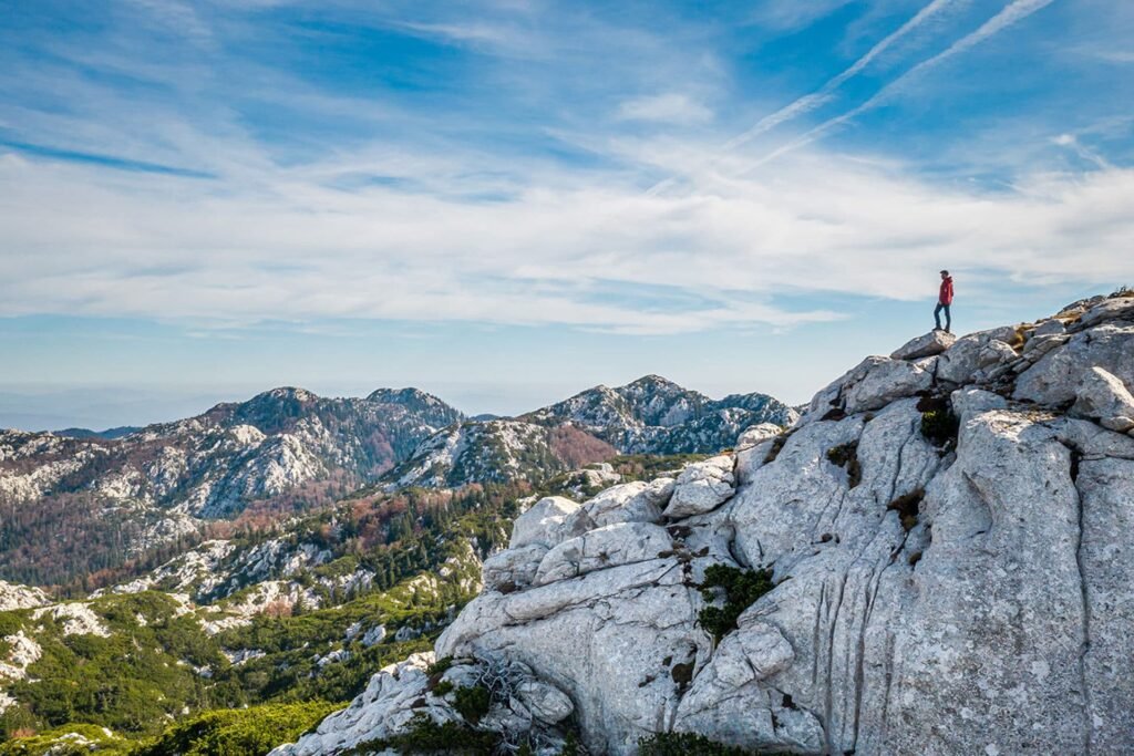
Northern Velebit National Park is the least visited and most rewarding of Croatia’s mountain hiking destinations — a UNESCO World Heritage Site and a Biosphere Reserve that contains some of the most pristine and most ecologically extraordinary mountain terrain in Europe, served by a network of trails that delivers consistently outstanding hiking with remarkably little company even during the peak summer season.
The park covers approximately 109 square kilometres of the northern Velebit massif — a high limestone plateau characterised by extraordinary geological formations, endemic plant species found nowhere else on earth, dense forest of beech and fir, and the dramatic pit systems (jame) that penetrate deep into the karst limestone and have been the subject of speleological exploration for decades.
The Premužić Trail — Croatia’s Greatest Hiking Route
The Premužić Trail is the finest single hiking route in Croatia and one of the great mountain walking paths in southeastern Europe — a 57-kilometre marked trail along the crest of the Velebit range from Zavižan in the north to Baške Oštarije in the south, constructed in the 1930s by the Croatian Mountain Rescue engineer Ante Premužić with extraordinary skill and care.
The trail was constructed on the principle of minimal gradient and maximum scenery — Premužić designed the path to follow the mountain contours in a way that avoids the steep ascents and descents of most mountain routes while maintaining altitude along the ridge crest, providing continuous views of the Adriatic coast to the west and the Lika plateau to the east. The construction technique — dry stone walls supporting the path where it crosses exposed limestone — is a masterpiece of mountain engineering that has survived nearly a century without significant deterioration.
The full Premužić Trail takes three to four days to complete as a point-to-point route — with overnight stays at mountain huts (planinarskih domova) at Zavižan, Alan, and Voštane. The trail can also be walked in sections from various access points — making it accessible for day hikers as well as multi-day trekkers.
Section 1 — Zavižan to Alan (Moderate — full day)
The northern section of the Premužić Trail begins at the Zavižan mountain hut and meteorological station — the highest manned meteorological station in Croatia at 1,594 metres — and traverses the northern Velebit crest southward to the Alan mountain hut. The section passes through the Hajdučki Kukovi and Rožanski Kukovi — extraordinary fields of eroded limestone pinnacles (kukovi) that create a landscape of genuine surrealism — jagged white rock formations rising from the green meadows of the plateau like the ruins of a petrified city.
This section of the trail is the most visually extraordinary in the northern Velebit and one of the most photographically rewarding hiking environments in Croatia. The kukovi fields are entirely unique to the Velebit — this geological formation exists nowhere else in Europe in comparable scale or complexity.
Section 2 — Alan to Baške Oštarije (Moderate — full day)
The southern section of the Premužić Trail passes through progressively more forested terrain as it descends toward the southern end of the northern Velebit. The views of the Adriatic are most frequent and most dramatic in this section — the trail crests several ridges where the entire Kvarner Gulf is visible and the islands of Krk, Cres, and Lošinj appear in the blue distance.
Getting to Zavižan: The northern trailhead at Zavižan is accessible by a mountain road from the town of Senj on the coast — the road is unpaved but passable by ordinary vehicles in good weather. A mountain hut at Zavižan provides accommodation and meals.
Best season: June through September. The northern Velebit receives significant winter snowfall and the high-altitude sections of the trail are not safe without winter equipment before late May or after late October in most years.
3. Plitvice Lakes National Park — The Boardwalk Experience
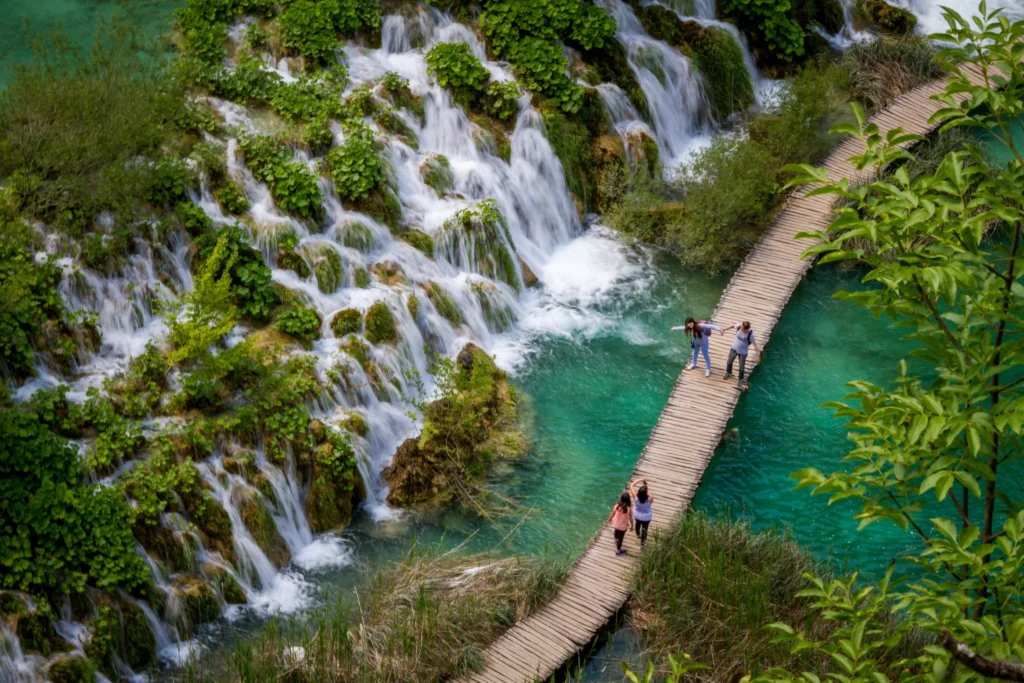
Plitvice Lakes National Park is Croatia’s most visited natural attraction and one of the most visited national parks in Europe — a UNESCO World Heritage Site whose system of sixteen interconnected lakes, connected by waterfalls of extraordinary beauty and linked by a network of wooden boardwalks and forest trails, attracts over 1.5 million visitors per year.
Hiking at Plitvice is a different category of experience from the mountain trails of the Velebit — it is lower impact, more easily accessible, and more immediately rewarding in terms of visual spectacle — but it is no less extraordinary for the difference. The combination of the turquoise and jade lake colours, the constant sound and sight of falling water, the forest setting, and the sheer variety of waterfall forms — from delicate veils of water over mossy tufa barriers to the dramatic 78-metre Veliki Slap (Great Waterfall), the highest waterfall in Croatia — creates a hiking environment of genuine and sustained beauty.
The Trail System
Plitvice offers several marked route options ranging from 2 to 8 hours in length — the park management designates these as Routes A through K, with different starting points and different combinations of upper and lower lake sections.
Route H — The Full Lake Experience (6 to 8 hours — Moderate)
Route H is the most comprehensive single-day trail at Plitvice — combining the upper lakes, the lower lakes, and the forest trails that connect them into a full circuit that provides the most complete experience of the park’s variety and scale. The route includes sections of boardwalk along the lake edges — where the water is close enough to touch and the clarity allows the lake floor to be seen at surprising depths — forest trail sections through the beech and fir forest that surrounds the lakes, and boat and shuttle bus connections between the upper and lower sections of the park.
Route C — The Lower Lakes Classic (2 to 3 hours — Easy)
Route C focuses on the lower lakes — the most dramatic section of the Plitvice system, where the largest waterfalls are concentrated and where the boardwalks run closest to the water. This is the most popular and most photographically spectacular section of the park — the Veliki Slap is located in the lower lakes area and is visible from multiple viewpoints along the route.
Route F — Upper Lakes and Forest (4 to 5 hours — Moderate)
Route F covers the upper lakes — a quieter and in some ways more intimate section of the park where the lakes are shallower, the colours more varied, and the crowds somewhat thinner than in the lower lakes. The upper lakes section includes some of the finest forest walking in the park and several viewpoints that provide panoramic perspectives on the lake system unavailable from the lower sections.
Honest Plitvice Assessment
Plitvice is genuinely extraordinary — the waterfall landscape is unlike anything available elsewhere in Europe and the combination of the water colours, the constant movement and sound of falling water, and the forest setting creates an experience of sustained natural beauty that justifies the enormous visitor numbers it attracts.
But those visitor numbers are a genuine challenge. In July and August Plitvice is extremely crowded — the boardwalks in the lower lakes section can become uncomfortable bottlenecks where progress is slow and the sense of natural immersion is significantly compromised by the crowd density. The park management has implemented timed entry tickets and visitor number limits in response to the overcrowding problem but even with these measures the peak summer experience is very different from the spring or autumn version.
When to visit: April to June and September to October are the finest months for Plitvice — the waterfalls are at their fullest from the spring snowmelt, the autumn colours are extraordinary in October, and the visitor numbers are dramatically lower than the summer peak.
Practical information: Timed entry tickets are mandatory and must be purchased in advance through the park website — do not arrive without a ticket during the peak season as entry may be denied. The park is accessible by bus from Zagreb (approximately 2.5 hours) and Zadar (approximately 2 hours).
4. Risnjak National Park — The Quiet Forest
Risnjak National Park is the most undervisited and arguably the most pristine hiking destination in Croatia — a mountain and forest environment in the Gorski Kotar highland region that receives a fraction of the visitor numbers of Plitvice or Paklenica despite offering trails of considerable quality and a wilderness atmosphere that is genuinely rare in central Europe.
The park covers approximately 64 square kilometres of dense beech and fir forest, highland meadows, and karst terrain centred on the Risnjak peak at 1,528 metres — the highest point in the Gorski Kotar region. The park takes its name from the ris — the Eurasian lynx — one of the most elusive predators in Europe, which survives in small numbers in the park’s forest.
Risnjak Summit Trail (Moderate to Difficult — 5 to 6 hours return)
The most rewarding single hike in Risnjak follows the marked trail from the park entrance at Bijela Vodica to the Risnjak summit — an ascent of approximately 900 metres through dense forest that opens onto highland karst terrain as the trail approaches the ridge. The summit panorama on clear days encompasses the Gorski Kotar forest, the Gulf of Kvarner, and the northern Velebit peaks — a view of extraordinary scope that rewards the considerable effort of the ascent.
The trail passes through forest of extraordinary quality — old-growth beech and silver fir of impressive size, with the particular atmospheric quality of ancient forest that is increasingly rare in Europe. Wildlife encounters — deer, wild boar, and the extremely lucky sighting of a lynx — are possible throughout the forest sections of the trail.
Getting there: The park entrance at Bijela Vodica is located near the town of Čabar — accessible by car from Rijeka (approximately 1 hour) or by bus to Delnice and taxi to the park. Public transport access is limited and a car is strongly recommended for Risnjak.
Best season: May through October. The park receives heavy winter snowfall and the higher trails are not safely accessible without winter equipment between November and late April.
5. Biokovo Mountain — The Makarska Riviera Backdrop
Biokovo is the dramatic mountain range that rises immediately behind the Makarska Riviera — one of the most popular sections of the Dalmatian coast — providing a striking visual backdrop to the coastal resort towns and offering hiking trails with some of the most extraordinary sea views in all of Croatia.
The Biokovo massif rises from sea level to the Sveti Jure peak at 1,762 metres — the second highest point in Croatia — in a horizontal distance of only a few kilometres, creating one of the steepest coastal mountain gradients in Europe. The combination of the dramatic altitude gain and the proximity to the Adriatic produces views from the upper Biokovo trails that are simply unmatched anywhere in Croatia — the Dalmatian coast stretching in both directions below, the islands of Hvar, Brač, and Korčula visible across the channel, and on clear days the mountains of Italy visible on the opposite shore of the Adriatic.
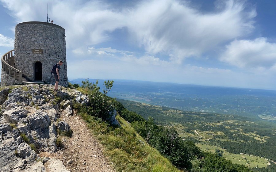
Sveti Jure Summit (Difficult — 6 to 8 hours from coast)
The trail to the Sveti Jure summit from the coastal town of Makarska is one of the most demanding but most rewarding day hikes in Croatia — climbing approximately 1,700 metres from sea level to the summit through the extraordinary karst landscape of the Biokovo protected area.
The ascent follows a well-marked trail through the lower Mediterranean scrubland, through the transition zone of mixed forest, and into the high karst terrain of the upper mountain — a complete ecological transect from Mediterranean coast to high mountain environment in a single day’s walking. The summit views are extraordinary.
The Biokovo Skywalk: A recent addition to the Biokovo visitor experience — a glass-floored platform extending from a cliff face at approximately 1,228 metres altitude that provides a vertigo-inducing view of the coast 1,200 metres below. The platform is accessible by car via the Biokovo road — making the view available to non-hikers — but the hiking approach from the coast provides a significantly more rewarding context for the experience.
Getting there: Makarska is easily accessible by bus from Split (approximately 1.5 hours) and Dubrovnik (approximately 3 hours). Trail access from the town centre is well-signed.
Best season: April to June and September to November. Summer hiking on Biokovo requires very early starts — the south-facing trails are extremely exposed and extremely hot in the midday summer heat.
6. Učka Nature Park — Istria’s Mountain Gem
Učka Nature Park protects the Učka mountain range — the highest mountain in Istria at 1,401 metres — that separates the Istrian peninsula from the Kvarner Gulf and provides a green, forested hiking destination in easy reach of the Istrian coastal towns.
The park is less dramatic than the Velebit or Biokovo but offers genuinely excellent hiking through dense forest with surprising views of both the Istrian interior and the Kvarner coast — the summit of Vojak (the highest point in Učka) provides panoramic views that encompass the Istrian peninsula, the Kvarner islands, and on exceptional days the peaks of the Slovenian Alps.
Vojak Summit Trail (Moderate — 3 to 4 hours from various trailheads)
The most popular trail in Učka follows the marked route to the Vojak summit — accessible from several trailheads on both the Istrian and Kvarner sides of the mountain. The trail passes through mixed forest of extraordinary quality — the Učka forest is one of the finest remaining examples of mixed deciduous mountain forest in Istria — before emerging onto the open summit terrain where the views unfold.
Getting there: Multiple trailheads accessible from the Istrian coastal towns — Lovran and Opatija on the Kvarner side provide the most accessible starting points.
7. Island Trails — Hiking the Dalmatian Archipelago
The islands of the Dalmatian coast offer a completely distinct category of hiking experience from the mainland mountain ranges — lower elevation, warmer temperatures, extraordinary sea views, and the particular pleasure of walking through a Mediterranean landscape of extraordinary beauty with the Adriatic visible from virtually every trail.
Hvar Island — The Lavender and Sea Trail
Hvar is primarily known as the Adriatic’s most glamorous party island — but the island’s interior offers hiking of genuine quality through a landscape of extraordinary Mediterranean beauty. The island’s central highland ridge — the Sv. Nikola ridge reaching 628 metres — provides trails with views of the Dalmatian coast that are among the most spectacular available from any island walking route in Croatia.
Sv. Nikola Summit Trail (Moderate — 4 to 5 hours return from Hvar Town)
The trail to the Sv. Nikola summit from Hvar Town climbs through the island’s extraordinary lavender and sage landscape — the scent of the combined Mediterranean herbs is overwhelming in May and June when both are in full bloom — and through pine and oak forest to the summit where the view encompasses the entire island, the surrounding Dalmatian coast, and the open Adriatic to the south.
The descent can be varied to return through the hill village of Sv. Nedjelja on the island’s south coast — a small wine-producing community accessible from the summit by a trail that drops dramatically to the sea through terraced vineyards.
Best season for Hvar hiking: May and June — the lavender is in full bloom, the temperatures are warm but not oppressive, and the island is less crowded than the July and August peak.
Brač Island — The Vidova Gora Hike
Brač Island — most famous for the extraordinary Zlatni Rat beach near Bol — is also home to Vidova Gora at 778 metres, the highest point of any Adriatic island. The summit trail from the town of Bol provides one of the finest island summit experiences in Croatia — the view from Vidova Gora encompasses the entire southern Dalmatian coast, the islands of Hvar, Šolta, and Vis in the middle distance, and the open sea stretching to the horizon in the south.
Vidova Gora Trail from Bol (Moderate — 4 to 5 hours return)
The marked trail from Bol climbs steeply through the island’s karst terrain — passing ancient dry stone walls, olive groves, and abandoned terraced fields that speak of centuries of agricultural activity on the island’s demanding limestone landscape — to the summit plateau and the extraordinary panorama.
The trail requires sturdy footwear — the limestone terrain is sharp and uneven — and sufficient water, as there is no reliable water source on the route. The combination of the summit view and the descent back to Bol with its extraordinary beach is one of the finest single-day combinations of hiking and swimming available in Croatia.
Vis Island — The Most Rewarding Island Walk
Vis Island — the most remote of the main Dalmatian islands, accessible only by a 2.5-hour ferry from Split — offers the finest island hiking in Croatia. The island’s combination of extraordinary natural beauty, relative remoteness from mass tourism, and well-developed trail network makes it one of the most rewarding walking destinations in the entire Dalmatian archipelago.
Hum Summit Trail (Easy to Moderate — 2 to 3 hours return)
The Hum summit — at 587 metres the highest point on Vis Island — is accessible by a well-marked trail from the village of Komiža on the island’s western coast. The summit view encompasses the entire island, the surrounding sea, the islands of Bisevo and Svetac to the west, and the open Adriatic stretching to Italy in the distance.
Coastal Trail — Vis Town to Komiža (Moderate — full day)
The trail connecting the two main towns on Vis Island — Vis Town on the eastern coast and Komiža on the western coast — crosses the island’s central ridge and provides a full day of varied walking through the island’s extraordinary interior landscape. The route passes through abandoned military installations from the Yugoslav era — Vis was a closed military island until 1989 and the remains of the military infrastructure add a fascinating historical layer to the natural landscape — and through vineyard and olive grove terrain before descending to Komiža.
Mljet Island — The National Park Walk
Mljet Island — described by some as the most beautiful island in the Adriatic — contains a national park in its western section that protects a landscape of extraordinary beauty centred on two saltwater lakes (the Malo Jezero and the Veliko Jezero) connected to the sea by a narrow channel.
Mljet Lakes Circuit (Easy — 3 to 4 hours)
The trail around the two Mljet lakes is one of the most beautiful easy walks in Croatia — a circuit of approximately 9 kilometres through the dense Aleppo pine forest that surrounds the lakes, with frequent lake views and several swimming opportunities in the extraordinary clear water. The trail passes the island of Sv. Marija in the Veliko Jezero — accessible by small boat — where a 12th-century Benedictine monastery provides a historical counterpoint to the natural beauty of the lake landscape.
8. Gorge and Canyon Hiking — The Dramatic Alternatives
Croatia’s karst geology produces extraordinary gorge and canyon landscapes throughout the country — several of which offer hiking experiences of considerable quality that are less well-known than the national park destinations.
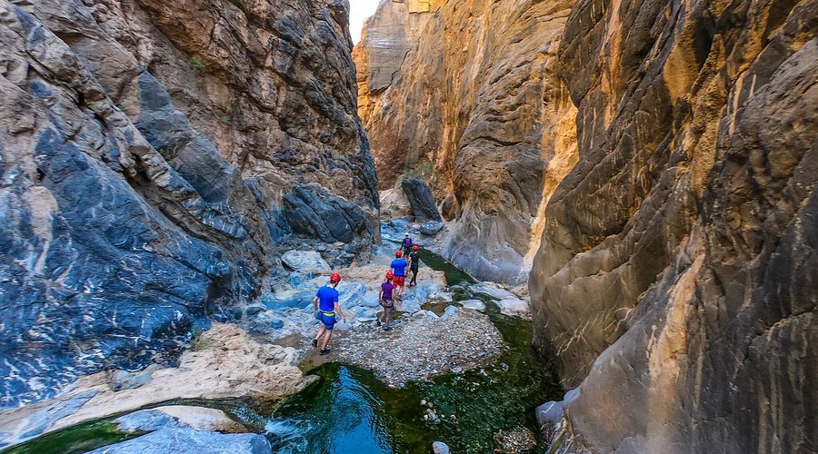
Zrmanja River Canyon
The Zrmanja River canyon in the northern Dalmatian hinterland is one of the most dramatic canyon landscapes in Croatia — a deep gorge cut through the limestone plateau by the clear, blue-green Zrmanja River, whose waters tumble over a series of waterfalls before meeting the Adriatic near the town of Obrovac.
The canyon is accessible for hiking along its rim — several trails follow the canyon edge providing extraordinary views of the gorge and river below — and by kayak on the river itself. The combination of rim hiking with a kayaking descent of the canyon makes the Zrmanja one of the finest adventure hiking destinations in inland Dalmatia.
Krupa River Canyon
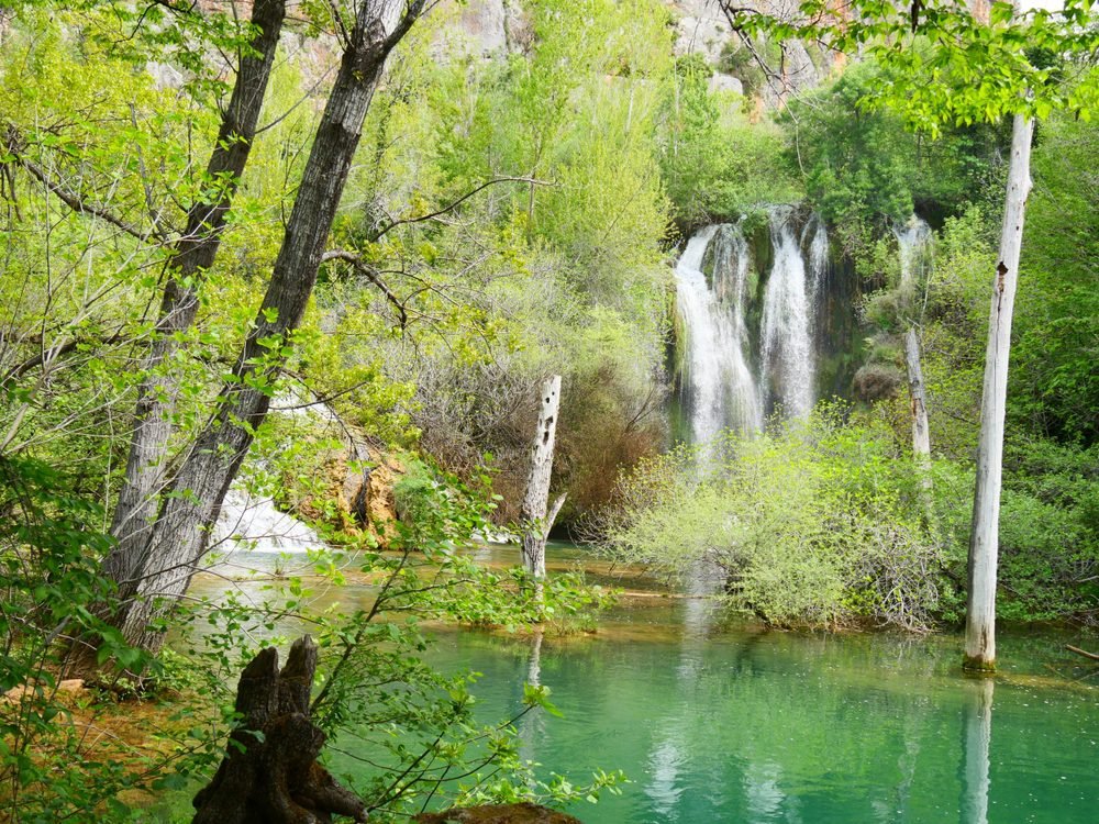
The Krupa River — a tributary of the Zrmanja in the northern Dalmatian interior — flows through a canyon of extraordinary beauty and extraordinary water clarity, with a series of waterfalls and pools that rival the more famous Krka and Plitvice in visual quality while receiving a fraction of the visitor numbers.
The Krupa canyon is accessible from the village of Krupa na Vodi — a short drive from the coastal town of Starigrad-Paklenica — and the trail along the river provides several hours of genuinely outstanding waterfall and canyon hiking in a setting of remarkable intimacy and natural quality.
9. The Coastal Paths — Walking the Adriatic Edge
Croatia’s coastline offers a growing network of marked coastal walking paths — routes that follow the Adriatic edge through a landscape of extraordinary Mediterranean beauty, connecting ancient fishing villages, Roman ruins, medieval fortresses, and natural landscapes of great variety.
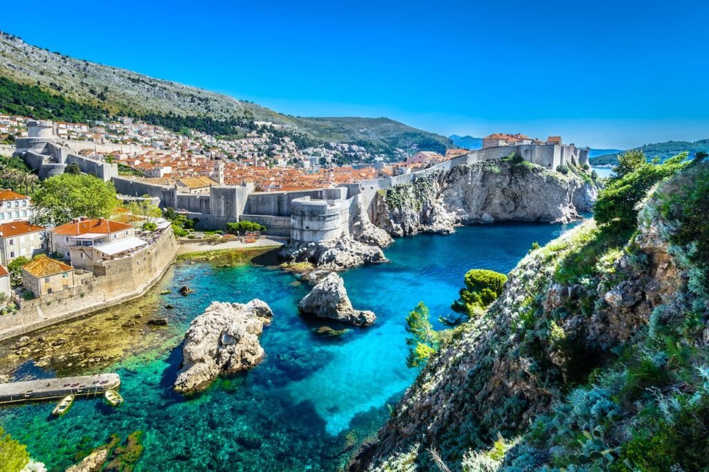
The Staza Petra Preradovića — Dubrovnik Coastal Path
The coastal walking path near Dubrovnik connects the old city with the surrounding coastline in a series of sections that provide views of the Adriatic and the old city walls from perspectives unavailable from the tourist routes within the city. The path extends in both directions from the old city — northward toward the Lapad peninsula and southward toward the Cavtat area — providing several hours of coastal walking accessible directly from Dubrovnik.
The Lungomare — Opatija to Lovran
The Lungomare is the finest coastal walking path in Croatia — a 12-kilometre promenade along the Kvarner Gulf coast connecting the elegant resort town of Opatija with the smaller town of Lovran to the south. The path was constructed in the late 19th century during the Austro-Hungarian era when Opatija was the most fashionable resort on the Adriatic — the original Austro-Hungarian infrastructure of the path has been maintained and extended and the walk provides extraordinary views of the Kvarner Gulf and the Učka mountain rising behind the coastal towns.
The Lungomare is accessible and family-friendly — suitable for all ages and fitness levels — but the views and the historical character of the path make it genuinely rewarding for serious walkers as well as casual strollers.
Practical Guide: Everything You Need to Know
When to Hike in Croatia
Spring (April to June) — The Finest Season
Spring is the best overall season for hiking in Croatia — the temperatures are warm but not oppressive, the wildflower displays are extraordinary, the waterfalls at Plitvice and Krka are at their fullest from the winter snowmelt, and the visitor numbers are significantly lower than the summer peak. April and May are particularly excellent months — the Dalmatian coast is warm enough for swimming after a hike and the mountain trails are clear of winter snow above approximately 1,200 metres.
The spring wildflower display on the Velebit — particularly the endemic species that exist nowhere else on earth — is one of the finest botanical experiences available in Croatia and one of the least known.
Summer (July to August) — Hot, Crowded, and Still Worth It
Summer hiking in Croatia requires adaptation rather than abandonment. The coastal and island trails are genuinely very hot between 10 AM and 4 PM — early starts (before 7 AM) and late afternoon walking (after 5 PM) make the most of the cooler hours. The mountain trails of the Velebit and Biokovo are cooler than the coast but still require heat management and generous water carrying.
The summer crowds at Plitvice are a genuine challenge — the park can feel overwhelmingly busy in peak July and August and the timed entry system, while helpful, does not eliminate the crowd density on the most popular boardwalk sections.
The mountain huts throughout the Velebit system are busy in summer — advance booking is strongly recommended for any overnight stays on the Premužić Trail or in the Paklenica area.
Autumn (September to November) — The Underrated Season
Autumn is the second finest season for hiking in Croatia and the most underrated. September temperatures are warm — often still warm enough for post-hike swimming — while the visitor numbers drop dramatically from the August peak. October brings extraordinary autumn colour to the beech forests of the Velebit, Risnjak, and Gorski Kotar — the combination of the autumn colour and the reduced crowds makes October one of the finest months for mountain hiking in Croatia.
The Plitvice autumn colour — the beech and maple forest surrounding the lakes turning gold and red against the turquoise water — is one of the most photographically extraordinary natural displays in Croatia and one of the finest reasons to visit the park in October rather than the summer peak.
Winter (December to March) — For the Experienced
Winter hiking in Croatia is limited primarily to the coastal and lower elevation routes — the mountain ranges of the Velebit, Biokovo, and Gorski Kotar receive significant snowfall and the higher trails are not safely accessible without winter equipment and experience. The Paklenica canyon trail remains accessible in winter and the canyon in snow and ice provides an extraordinarily beautiful environment for experienced winter walkers.
What to Wear and Carry
Footwear: Sturdy ankle-supporting hiking boots are essential for all mountain and canyon trails in Croatia. The karst limestone terrain is the most demanding surface for footwear — sharp edges, loose rocks, and uneven surfaces that are extremely hard on ankles and feet in anything less than proper hiking boots. Trail running shoes are acceptable for the easier coastal and island trails but inadequate for the Velebit, Paklenica, or Biokovo.
Water: Water carrying is the single most important practical consideration for hiking in Croatia — particularly in summer and on the mountain and island trails where reliable water sources may be widely spaced or absent entirely. Carry a minimum of 2 litres per person for any trail over 3 hours. Carry 3 to 4 litres for summer mountain hiking. Water filters or purification tablets allow safe use of trail springs — many of the mountain springs in the Velebit are safe to drink but confirmation from local guides or rangers is advisable.
Sun Protection: The Croatian sun — particularly on exposed coastal, island, and mountain ridge trails — is extremely intense from May through September. High-factor sunscreen (SPF 50), a wide-brimmed hat, and UV-blocking sunglasses are essential rather than optional. Sunburn on an exposed ridge at 1,500 metres happens faster than at sea level and the consequences are more serious.
Navigation: The Croatian Mountain Rescue Association (HGSS) maintains the mountain trail network and the trail marking — red and white circular blazes on rocks and trees — is generally reliable but not universally comprehensive. A downloaded offline map (Maps.me or Komoot) is strongly recommended as a backup navigation tool. The Komoot Croatia hiking maps are particularly good for the Velebit and Paklenica trails.
Emergency contacts: The Croatian Mountain Rescue Service is contactable on 112 (general emergency) — Croatia’s general emergency number. In mountain areas with mobile coverage the 112 system connects to the mountain rescue service. Register your hiking intentions with accommodation providers or park rangers before undertaking serious mountain routes.
Accommodation for Hikers
Mountain Huts (Planinarskih Domova)
Croatia has an extensive network of mountain huts throughout the major hiking areas — maintained by the Croatian Mountaineering Association (HPS) and by individual hiking clubs. The huts provide dormitory accommodation, basic meals, and water for overnight hikers.
Key mountain huts for hikers:
- Zavižan Hut — Northern Velebit — the starting point for the Premužić Trail
- Alan Hut — Northern Velebit — midpoint of the Premužić Trail
- Paklenica Hut — Velika Paklenica Canyon — base for Paklenica summit routes
- Risnjak Hut — Risnjak National Park — base for Risnjak summit trail
- Biokovo Hut — Biokovo — base for Sveti Jure summit route
Advance booking is strongly recommended for summer visits to all mountain huts — the HPS website and direct hut contact information is available from the Croatian Mountaineering Association.
Camping
Wild camping is not legally permitted within Croatian national parks or nature parks. Designated camping areas are available at several locations within and near the major hiking areas — the Paklenica area has several campsite options near the park entrance and the Plitvice area has designated camping near the park.
Guided Hiking in Croatia
For visitors who want expert local knowledge — particularly for the more remote Velebit routes and for wildlife-focused hiking — several Croatian guiding companies offer excellent guided hiking experiences.
The Croatian Mountaineering Association (HPS) can provide recommendations for certified mountain guides throughout the country. Several private guiding companies — including Croatian Hiking and Adventure Croatia — offer day trips and multi-day guided routes in the major hiking areas.
Guided hiking is particularly valuable for:
- First-time Velebit visitors — the trail network is extensive and navigation requires local knowledge on the more remote routes
- Wildlife-focused hiking — lynx tracking in Risnjak, endemic plant identification in the northern Velebit
- Multi-day Premužić Trail traverses — logistics coordination for the hut-to-hut route
The Long Distance Trails: Multi-Day Hiking in Croatia
The Velebit Hiking Route (VPP)
The Velebit Hiking Route is a waymarked long distance trail traversing the entire length of the Velebit range from north to south — a route of approximately 145 kilometres that takes 8 to 12 days to complete and represents the finest long distance hiking experience available in Croatia.
The route combines sections of the Premužić Trail in the northern Velebit with routes through the middle Velebit and the Paklenica section of the southern Velebit — providing a complete transect of the range from the Kvarner Gulf area to the Dalmatian hinterland near Zadar.
Completing the full Velebit Hiking Route requires logistical planning — water resupply, hut booking, and access arrangements at beginning and end points — but the reward is one of the most complete and most sustained mountain hiking experiences available in southeastern Europe.
The E7 European Long Distance Path
The E7 European Long Distance Path passes through Croatia as part of its route from Portugal to Cyprus — entering Croatia from Slovenia in the northwest and traversing the country southeastward through the Gorski Kotar, the Plitvice area, and the Dalmatian hinterland before crossing into Bosnia and Herzegovina.
The Croatian section of the E7 has been partially waymarked and partially developed as a hiking route — some sections are well-marked and maintained while others remain in development. For hikers interested in the European long distance context of Croatian hiking the E7 provides a framework for multi-day routes that connect several of the country’s finest hiking regions.
Final Thoughts: Croatia on Foot
Croatia reveals itself most completely to the traveller who is willing to leave the coast occasionally and explore the country on foot. The hiking landscape — the dramatic canyons of Paklenica, the extraordinary ridge trail of the Premužić, the waterfall boardwalks of Plitvice, the island summit views of Vidova Gora, the coastal Mediterranean paths of the Lungomare — is as diverse and as visually rewarding as any hiking landscape in Europe.
The combination of hiking and swimming that Croatia uniquely offers — a morning on mountain trails followed by an afternoon in the Adriatic — is one of the finest active travel experiences available anywhere in the world. The spring and autumn seasons deliver this combination most perfectly — the warmth sufficient for comfortable swimming while the temperatures remain ideal for serious hiking.
Croatia’s hiking trails are neither as famous nor as crowded as the Alpine routes of Switzerland or Austria — and this relative obscurity is one of their most valuable qualities. The Velebit in October, the Paklenica canyon in April, the Vis island trails on a weekday in May — these are places of genuine quietness and genuine natural beauty that reward the traveller who makes the effort to find them.
Lace up your boots. Leave the beach chair for the afternoon. And discover the Croatia that exists above the coastline — wider, wilder, and more extraordinary than most visitors ever suspect.